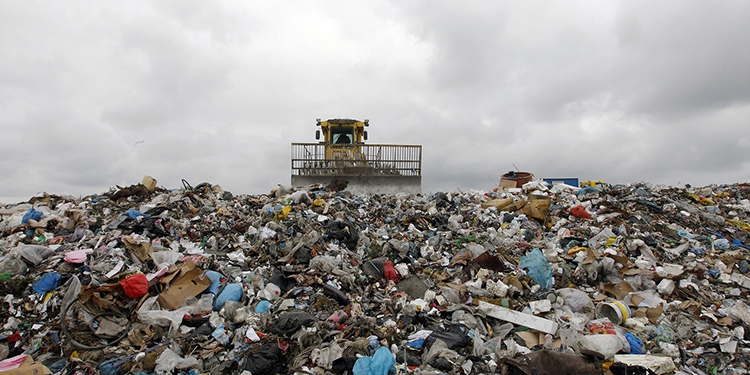
How Drones are Helping with Waste Management
Industries and their established processes are being redefined as a result of the advancement of drone technology. Unmanned aerial vehicles (UAVs) have once again shown to be the most cost-effective, practical, efficient, and precise equipment in the waste management business. With only a little practise, you may launch a drone programme on your landfill to provide precise and real-time statistics on the progress and production of your landfill. You may expect high-quality work from drones, as well as fewer operational risks and waste management costs. Convert your data into 3D models to conduct in-depth analyses of your landfills and make smart decisions. Drones are not only beneficial to your trash management company, but also to the environment's safety.
KEY COMPONENTS FOR A SUCCESSFUL PROGRAM
Check your local aviation restrictions before flying a drone. Drone regulations vary by area. Your country's aviation authority develops extensive rules and regulations for the operation of unmanned aerial vehicles (UAVs). Drone laws are published on the websites of aviation authorities and are critical for drone pilots to understand and follow. Drone operators must be familiar with drone regulation 'X,' which includes questions like What kind of licence do you need? Are you flying over an area that has been designated as a 'No Fly Zone'? Do you have all of the essential permits to conduct business in the area? Several authorities, for example, have set the drone's weight to be flown, the maximum height to which it can be operated, the requirement to maintain a visible line of sight, and so on.
Choose the optimal hardware Drone pilots have a plethora of options when it comes to the type and model of drones they can use for trash management. Choosing the appropriate drone, on the other hand, can be difficult. The size of the survey area, budget, sort of camera required for surveying applications, and if RTK-enabled equipment such as the DJI Phantom 4 RTK drone is necessary are all important considerations.
Drone type Drone pilots have the option of flying fixed-wing or multicopter drones. Multicopters are typically mass-produced, making them a more accessible and cost-effective option. Multicopter UAVs should be your first choice if the survey area for your waste management activities is smaller than 500 acres. Fixed-wing UAVs, on the other hand, may be much more expensive, but they are ideal for broader surveying areas. Fixed-wing quadcopters, on the other hand, may be difficult to use in 'No Fly Zones' or crowded areas due to their weight and demand for a runway strip for a safe landing.
Budget A budget should be set as one of the most important factors that will influence your drone choices. Multicopters, particularly the DJI types on the market, are mass-produced in large quantities. Because of this, they are readily available and relatively inexpensive in comparison to other models. Fixed-wing UAVs, on the other hand, are built in limited quantities, making them a significantly more expensive investment. Despite the fact that the budget limits the options available to the drone pilot, the quadcopter of choice should not compromise the quality or output of data in any way.
Availability and ease of maintenance Aside from the purchase price, the cost of maintenance and the availability of components and replacements are important considerations to consider. It is recommended that drone pilots use simple models that can be repaired and replaced quickly if necessary. Drone faults cost money and effort, so quick and easy maintenance saves both. Consider the following scenario. If you're piloting a DJI drone at an event and it crashes due to a combination of high winds and mechanical failure, repairing damaged parts of the UAV is simple thanks to the market's availability. Due to such circumstances, the drone pilot would not need to postpone his surveying/inspection tasks.
Camera It's not impossible to get a low-cost drone while maintaining the quality and resolution of the photographs and videos seized! There are a variety of UAVs available that are great for surveying and inspection applications in a variety of sectors while remaining economical. A traditional drone camera for aerial surveying purposes must have at least 20 MegaPixel sensors. Interchangeable lenses frequently confound surveying methodologies and dilute the value of data collected. The drone operator must ensure that the camera specifications limit the Ground Sample Distance (GSD) in order to maintain data resolution. High-resolution cameras with influential sensors, together with the art of GIS and Photogrammetry, yield more detail for accurate 3D photos and 3D point clouds that can be used for further analysis.
Software The right combination of hardware and software can help you get the outcomes you want. You must choose software that meets the needs of your drone applications as well as the amount of inspection and management that the user requires. Photogrammetry allows you to take images and turn them into 3D models of the original location. The correct programme will provide you with all of the information you require about your asset. For example, after running your data through the appropriate visualisation tools, you may be provided with a Digital Terrain Model (DTM) that displays elevations, contour lines, break lines, and other features. Pixa 4D is a cloud-based application and photogrammetry programme. It is well-known for its use in the creation of maps and 3D models.
Leave a Reply